Thoroughly sun-dried myself by now, I entered Borgofranco d'Ivrea (which also has a railway station not mentioned in the guide) just after midday


 No. 3
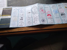
No. 3

and took a couple of milkshakes across the road from its neoclassical church facade.
A man and his friend came to a nearby table and he started having a loud and very extended conversation on his 'phone in a local dialect. Then, clearly at a loss as how to entertain himself, his companion started another 'phone conversation. Thank goodness they didn't have to speak to each other while they went out together for a coffee.
It was here that I managed to pick up an Italian man, who joined me on the way through flat deciduous woods , as we said a final farewell to the mountains,
and then uphill again towards Lake Pistono, where we parted. We were so engrossed in our conversation that we didn't notice the climb. He explained that in Valldaosta, there are so many trails and hikers that the Via is of little consequence, hence the somewhat lackadaisical attention to accuracy in its signage, whereas in Piedmont, the pilgrim is highly respected, and this is reflected in very clear, frequent and helpful signs.
After regretfully waving goodbye to my lovely young Italian, there was more uphill then finally down, through the toffs' part of town, and into the centre of decidedly more metropolitan Ivrea, where, after 23km in 34C, this adventure on the Via ends until next year.
However, you can take part in a quiz: identify, please, these wildflowers and enter your suggestions in the comments section.
No. 1
No. 2